Understanding geological maps
tutor: Mike Horne FGS
for the Centre for Life Long Learning
To understand a geological map you have to think in four dimensions.
You can see two dimensions on the map - a plan of the area with and interpretation of the geology.
You have to add the third dimension - the vertical
the topography of the land itself (from contours on the map)
the possible outcrops of the rocks (from the map)
the subcrop of the rocks (from the dip and strike shown on the maps and from your experience an knowledge of geology)
You have to add the fourth dimension - geological time
your interpretation of the sequence of the rocks (from your experience and understanding of geology)
dating of those rocks (from information given on the map and you knowledge of geological history)
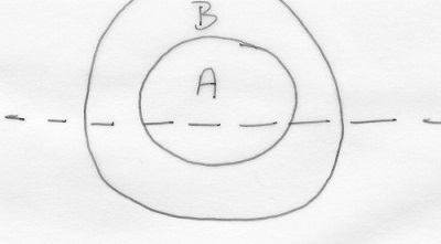
Here is a simple example -
there are several ways to interpret this map:
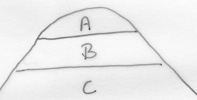
it is a hill with rocks deposited in the sequence C (oldest), B and A
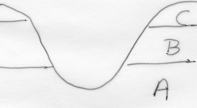
it is a valley with rocks deposited in the sequence A (oldest), B and C
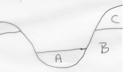
it is a valley with the floor filled with sediment (rocks deposited in the sequence B, C and A)
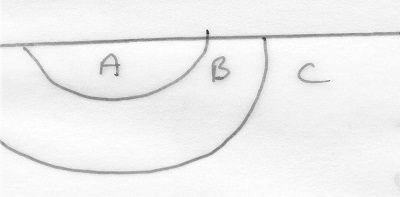
it is a syncline with rocks deposited in the sequence C (oldest), B and A
it is an eroded anticline with rocks deposited in the sequence A (oldest), B and C
it is a hill with an igneous dyke intruded into existing rocks ( sequence C, B and A)
an igneous intrusion A has altered rock C to create metamorphic rock B
there are other possibilities involving unconformities
copyright Mike Horne - May 2019
Hull Geological Society Home Page Geology Courses Homepage