Hull Geological Society
News archive 2017-2018
Copyright Hull Geological Society.
(updated 20th March 2019)
Thursday 6th December 2018 - Paul Hildreth on "Women in Geology"
Abstract - “This talk was inspired by a
meeting of the Yorkshire Geological Society, “Leading Yorkshire Figures in the
History of Geology” in 2017 which featured many individuals but none of them
women. A little research into women geologists generally revealed that
there had been outstanding contributions and that their achievements, more often
than not, had been against the odds. In more recent years several women stood
out despite them working in a male-dominated branch of the sciences.
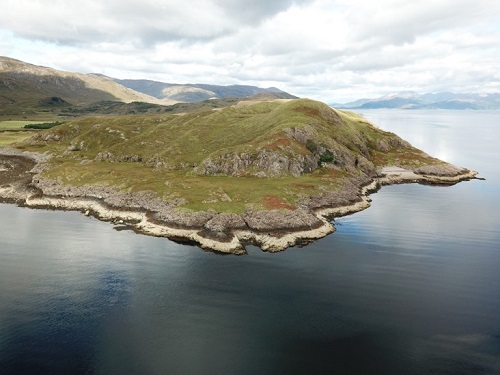
November 2018 (postponed) - Dr Eddie Dempsey of Hull University on "The Great Glen Fault Zone - Back and forth for longer than we thought"
Abstract - "
Deformation in the upper crust
during orogenesis is often characterised by the reactivation of
pre-existing structures. Unravelling the early deformation history of such
structures such as the Great Glen Fault Zone (GGFZ) is generally problematic due
to overprinting by subsequent events. While the Devonian to Oligocene movements
of the GGFZ are well documented, the earliest deformations associated with this
fault remain contentious with both sinistral and dextral early movements
proposed. The GGFZ consists of a poorly exposed ̴
300m wide intensely deformed fault core and a series of parallel synthetic high
angle strike-slip faults. One such parallel structure is the Rubha na h-Earba Fault
sits approx. 300m from the inferred GGFZ core and is exposed on the North shore
of Loch Linnhe at Kilmalieu. Due to its proximity to the GGFZ it is reasonable
to assume a common deformation history. Field analysis reveals, four distinct
high angle fracture sets; Group 1 (ENE/WSW); Group 2 (N/S) and; Group 3 (NW/SE)
and; Group 4 (NE/SW).Group 1 are associated with green cataclasites,
slickenlines and R-shears. They predate the deposition of the overlying lower
Devonian Rubha Na
h-Earba Sandstone
Formation. These are the earliest recognised GGFZ related structure and display
dextral shears sense and are consistent with dextral motion of the Rubhba na
h-Earba Fault within the GGFZ. Group 2 structures are associated with
widespread brecciation and oxidation of the fault rock and are regularly seen to
cross cut the Group 1 structures. Shear sense indicators (R-shears, oversteps,
jogs, and offsets) are typically sinistral and are consistent with sinistral
motion of the Rubha na h-Earba Fault. Group 3 are associated with minor
calcite mineralization and camponite-monchiquite dykes emplaced during
Permo-carboniferous dextral motion of the GGFZ. These structures regularly
overprint groups 1 and 2 (locally reactivate group 2) and are predominantly
tensile or dextral. Finally, Group 4 strike parallel to the Rubha na
h-Earba Fault are heavily brecciated with cataclasites present. Shear sense
indicators associated with these structures are mostly sinistral but dextral
motions are common suggesting a complex reactivation history. Stress inversion,
slip and dilation tendency modelling indicate that the Group 1 structures
may have resulted from a regional stress regime consistent with E/W Scandian
compression. This raises the intriguing possibility that the GGFZ formed as a
Scandian transform fault at the southern end of the Moine Thrust Zone.
At the Annual General Meeting in 2018 the following policies were adopted -
That the Safety Policy be amended by adding a
paragraph about working near cliff or quarry faces and a sentence about
generic risk assessments.
That the Treasurer will only issue a receipt for
payment of the annual subscription if specifically requested by a member.
That the Committee should update the
Data Protection
Policy to meet the requirements of the new General Data Protection
Regulations
Thursday 15th March 2018 - Dr Katie Strang on "Urban geology: buildings rock!"
Abstract -
Stone is one
of our most important natural resources here in the UK and the local stone has
provided a source of high quality, versatile and durable building material.
Scotland has one of the richest legacies of traditional (pre-1919) buildings and
other stone structures of any country in the world and the most common types of
building stones are directly influenced by the areas underlying local geology.
In Glasgow, many of the stone buildings were built in the second part of the
19th century and are now some of the stonework is showing signs of decay and
calls for repair. Years of accumulation of air pollution from industry and
domestic coal burning through much of the 20th century has accelerated stone
decay in many parts of the city. Furthermore, inappropriate repairs have
resulted in worsening of the problem. This talk will outline the most common
building stones in Scotland and the North of England and the important physical
properties of these building stones, and the importance in choosing a suitable
replacement in building conservation.
Thursday 25th January 2018 - Dr Liam Herringshaw of Hull University "Burrowing Through Time".
Abstract - "My plan in this talk is to try and explain why burrowing worms are amongst the most important creatures on Earth (something that Darwin first realised), why they were crucial to the Cambrian Explosion of life on Earth, and also how fossilized burrows can affect the properties of economically important rocks, from oil and gas reservoirs to aquifers (not to mention shales that might be fracked). Last but not least, I will introduce the strange science of ichnology, and its even stranger practitioners, including the Oxford professor who made tortoises walk on pie dough."
Prof. John Catt died on 7th December 2017.
John had been a member of the Society since 2006. He had been associated with
Hull and Holderness for a long time; studying for his PhD with Lewis Penny at
the University and writing extensively about the Quaternary ice ages in the
region.
Thursday 14th December 2017 - Ian Heppenstall on "Grassington, Lea Green to Conniston Dib"
Abstract -
The area to the north of Grassington
including Grass and Bastow Woods, Lea Green, Kimpergill, White Nook Dib, the Old
Pasture and concluding with Conistone Dib contain a wealth of glacio-karst
features, numerous Bronze and Iron Age remains and, from a more recent period
are crossed by a maze of lead workings. Large parts of these areas were cleared
of trees at an early period and unlike many other places the monks of Fountains,
or any other abbey were only allowed limited access. The dip of the limestone
gives rise to a secondary valley formation high above and 'parallel' to the main
valley of Wharfedale but still part of it with Conistone Old Pasture forming a
high ridge between them. Other high features can be seen in the raised valley
before the ground rises again towards the alternating layers of gritstones and
limestones of Grassington Moor to the east of both Conistone and Grassington
where, once again, many lead workings are to be found. All in all this is a most
fascinating part of Higher Wharfedale.
Thursday 9th November 2017 - Dr Rob Newton of Leeds University
on "The early
Toarcian (Jurassic) oceanic anoxic event: untangling global and regional
signals
Malcolm Fry died on 19th June 2017 - Paul Hildreth has written an obituary
19th October 2017
-
Professor Patrick Boylan: Geological Sites on the World Heritage List
In 1972 the United Nations Scientific, Educational and Cultural Organisation
(UNESCO) adopted the World Heritage Convention, which aims to promote and
support the conservation of the world’s cultural and natural heritage. This can
be considered one of the world’s most successful international treaties in any
field, as it has now been adopted by 193 States (and through them perhaps at
least 30 subsidiary self-governing territories in addition). Though the original
primary aim was that States adopting the Convention would adopt and implement
national policies that would protect all aspects and levels of their national
heritage, it must be admitted that its runaway success has been the secondary
aim of establishing a World Heritage List identifying site and monuments etc.
considered to of the highest universal value and significance to the whole of
humanity.
Nominations for Inscription on the World Heritage List can only be made by
States Parties, and these are then evaluated and voted on by an elected World
Heritage Committee. However, in practice many States tend to prioritise their
major national heritage resources with the aim of gaining additional
international recognition and - increasingly - tourism numbers.
Disappointingly, though geological interest and
importance is one of the major criteria for inscription on the World Heritage
List, in practice reatively few sites have been Inscribed wholly or partly
because
Patrick Boylan, a Past President and Honorary Member of the Hull Geological
Society and Professor Emeritus of Heritage Policy and Management at City
University of London, was for many years an adviser on museums, heritage and
conservation to UNESCO, including the World Heritage Committee, and over the
past forty years he has visited personally a significant proportion of the
natural and cultural sites and monuments now on the World Heritage List.
In this illustrated lecture he will outline not just the operation of the
Convention, but also the geological interest and significance of many of the
geological sites on the List.
Thursday 16th February 2017 - Dr Mike Widowson of Hull University "Divining the Deccan: Tectonics, stratigraphy, timing and effects of a major Large Igneous Province (LIP)"

Abstract
Since
publication
of the milestone paper by Alvarez et al.1, the Cretaceous –
Tertiary boundary (KTB) mass extinction has generally been considered the result
of the Chicxulub impact and its attending environmental effects; a view
reinforced by the recent contribution by Schulte et al.2. The main
alternative hypothesis,
Previous
dating studies of the Deccan Traps,
2.
Schulte et al. (2010)
Science
327 (no.
5970), 1214-1218.
3.
Chenet, A.L., et al.
(2008), Journal of Geophysical Research.,
113,
B04101, doi:10.1029/2006JB004635.
4.
Self, S., Widdowson, M., Thordarson,
T. and Jay, A.E. (2006) Earth and
Planetary Science Letters,
248,
517 - 531.
5.
Jay, A.E. and Widdowson, M. (2008)
Journal of the Geological Society of
London, 165, 177-188.
6.
Hooper, P.R., Widdowson, M. and Kelley, S.P. (2010)
Geology
38(9), 839-842.
Thursday 19th January 2017 - Ian Heppenstall on "the Geology along the north and middle Craven Faults between Malham and Threshfield".
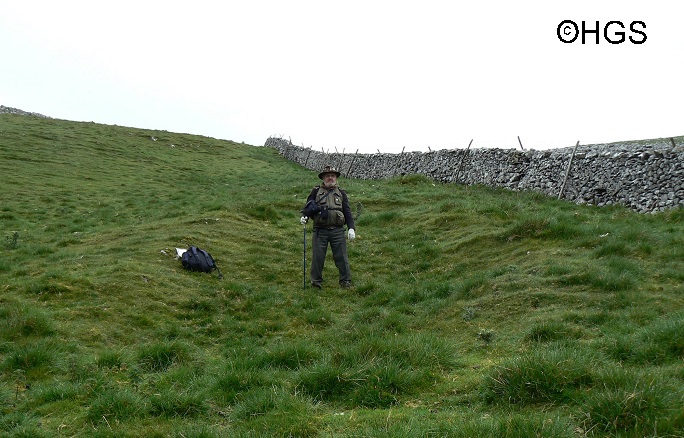
Abstract - Near Malham the North and Middle Craven Faults begin to converge, being at their closest in Threshfield . Parts of their courses are indistinct but across Threshfield Malham Moor and Threshfield Moor they show up very plainly, whilst there are other geological, archaeological and historic features around and adjacent to them. By means of maps and photographs I will show and explain these features.
Copyright - Hull Geological Society 2020
Copyright Hull Geological Society.
Registered Educational Charity No. 229147